Notes on the Hudson River Access Project
Every year, Pratt Center awards Taconic Fellowships to Pratt Institute faculty, staff, and students working on collaborative community development projects throughout New York City. This year’s fellows were invited to share insights from their work with Notes On. This note was authored by Sara Eichner and Sara Hodges who are creating a map that empowers individuals to connect with the Hudson and NY Harbor Estuary.
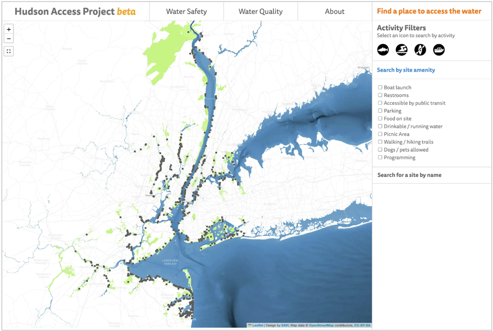
Access to the waterfront in the New York City area has increased dramatically in recent years, but there is not a reliable source for comprehensive, up-to-date information about where people can safely access the water. The Hudson Access Project aims to fill that knowledge gap and empower individuals to connect with the Hudson and Harbor Estuary. The project is in its second year, and to date has successfully created a foundational database of places where people can access the Hudson River and tidal estuary, a beta-version interactive website that makes this information available to the public, and has piloted year one of a five-year summer data collection fellowship for long term maintenance of the database. The website and database provide insights into accessibility, amenities, facilities, and regulations, allowing the public to make informed decisions regarding their waterfront experiences.
Connecting people to the Hudson Estuary is a critical step in engaging a greater proportion of the public in its stewardship and in promoting a sense of collective ownership. At the same time, a thorough understanding of where and how the water can be accessed is a first step in understanding (and correcting) inequity in access to green (or in this case blue) spaces. This understanding is essential to future planning and decision-making for climate change resilience, and for creating greater equity in access in the future.
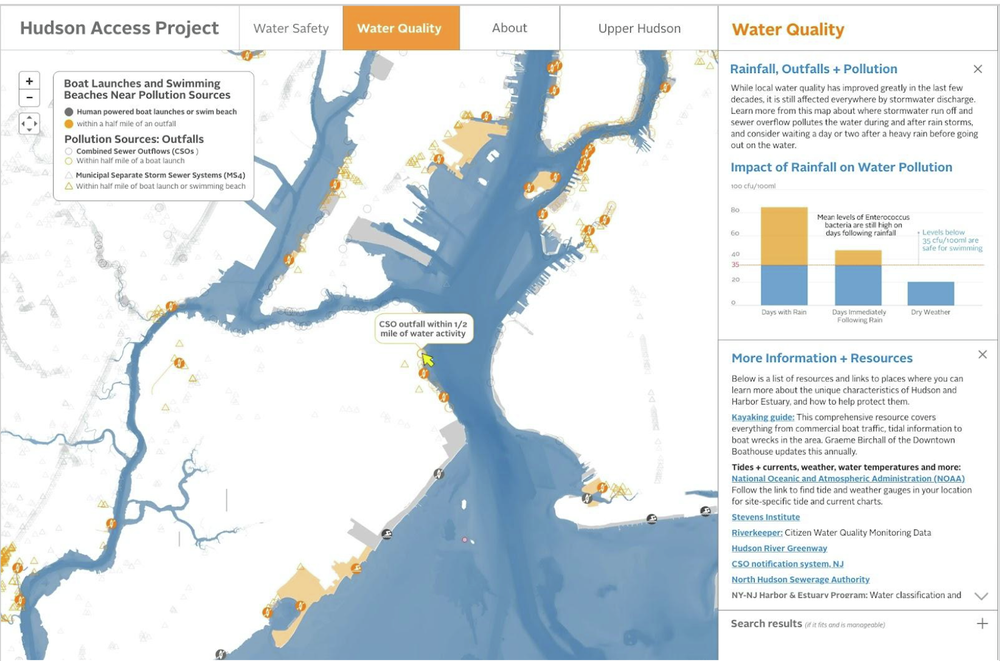
There are numerous barriers to building a comprehensive database of public access sites. The Hudson Estuary waters span 14 counties in two states, and the spaces are managed by numerous jurisdictions (private, municipal, county, state, or federal). No common standard has been followed in the creation of the datasets that do exist, and no one has consolidated all of this data to make it accessible in one space. Instead, public access sites are tracked differently by different jurisdictions; some by address, some by park boundaries, and some not at all. Some data tell us what activities are possible at the site, but many records are outdated, and some tell us nothing. And none of it is consistent. In order to quantify and understand public access and to qualify that access, we need to be able to see all of the data consolidated and standardized in one space. The Hudson Access Project was formed to tackle this problem. The database is already being used by the NY-NJ Harbor & Estuary program to represent and quantify public access around the region in the forthcoming 2025 State of the Estuary and by members of the Public Access Working Group (PAWG).
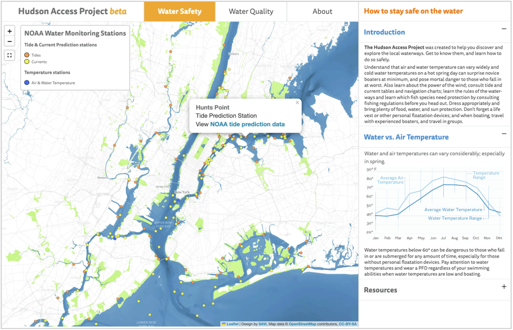
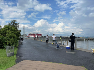
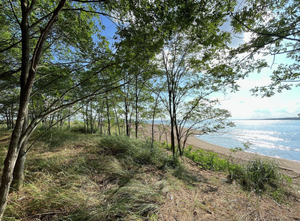
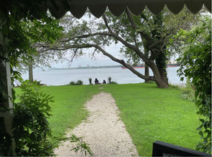
For the first half of the fellowship, we have focused on developing meaningful water safety resources for people on the water, and on website design and usability improvements. Since much of this work takes place at our desks, we also made time to visit a few sites in Staten Island. Validating the data on the ground ensures information about public transit and spatial extents are correct, and that the activities and programming listed for each site are current and accurate. Testing the sites in person provides insight we can’t get through looking at data alone and helps us continue to refine the questions we ask to make the information meaningful and relevant.
The second half of the fellowship will involve additional data validation through desktop research and field collection, as well as work with our community partner, the Public Access Working Committee (PAWG) who provides feedback to ensure the website is useful to community members. We’re working with PAWG to learn more about community concerns for public access in underserved areas and for insight into questions that can be asked with the database regarding environmental justice and access equity.
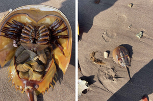
No amount of funding and time will allow us to visit every site in the region so we encourage readers to participate. Find a site off the beaten track on the map and get out there to explore! When you do, send us notes and photos at hudsonaccessproject@gmail.com and we’ll add them to the Hudson Access Project website and database.
The Hudson Access Project was created in collaboration with the New York - New Jersey Harbor & Estuary Program (HEP) and their Public Access Working Group (PAWG) with additional funding from a New York State Department of Environmental Conservation (DEC) River Access grant.